
Rising sea levels are not only threatening the United States East Coast but also submerging some of the country’s biggest cities, including New York and Baltimore, according to NASA photos.
A NASA-funded team of scientists working at Virginia Tech’s Earth Observation and Innovation Lab discovered that the geographical problem is “happening rapidly enough to threaten infrastructure, farmland, and wetlands that tens of millions of people along the coast rely upon”.
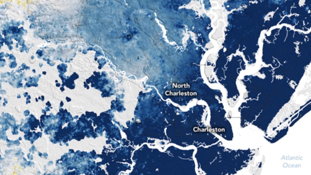
The scientists examined satellite data and GPS sensors to better understand the movements of the coast and uncovered infrastructure in major cities such as Norfolk and Baltimore. New York and Virginia are built on soil that has fallen significantly between 2007 and 2020.
The land sunk by an average of 1 to 2 mm per year; however, some counties in Delaware, Maryland, South Carolina, and Georgia saw the soil drop twice or three times as quickly. According to scientists, the land in wetlands sinks by more than 3 mm per year. Forests have also been displaced as a result of saltwater intrusion and ground subsidence.
However, wildlife is not the only thing that has been impacted. The subsiding land has over 897,000 constructions, including highways and airports. The findings, which followed another investigation conducted at the Virginia Tech lab, were reported in PNAS Nexus. Photos by NASA show that the mid-Atlantic region is sinking significantly.
NASA developed the maps using data obtained from satellites in the United States, Japan, and Europe
NASA developed the maps using data obtained from satellites in the United States, Japan, and Europe. The photographs show the Mid-Atlantic region sinking more, which is caused by the Laurentide ice sheet, which began retreating 12,000 years ago and caused the region to sink downward.
Leonard Ohenhen, a geophysicist at Virginia Tech, told Newsweek “In this research, we analyzed satellite radar data to assess how land subsidence increases the vulnerability of communities, properties, and infrastructure to coastal hazards. Our major findings show that between 2,000 to 74,000 square kilometers of land area, which is home to 1.2 to 14 million people and 476,000 to 6.3 million properties, are sinking at a rate of 1 to 2 millimeters per year.”
“This sinking land affects more than half of the infrastructure in several major cities, putting them at an increased risk of flooding and other coastal hazards,” he added.