

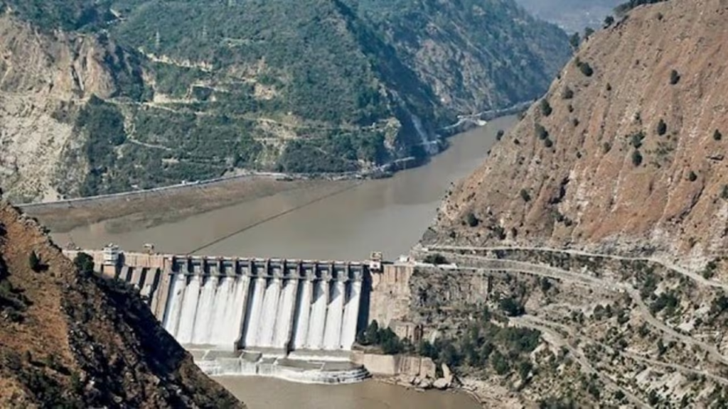
China’s ambitious plan to build the world’s largest hydropower project on the Yarlung Tsangpo River in Tibet is facing fresh scrutiny after a study by state-backed geologists warned that the site sits atop an active fault line, raising concerns over the dam’s long-term structural safety.
The proposed hydropower project, expected to generate 300 billion kilowatt-hours (kWh) of electricity annually—roughly three times the output of the Three Gorges Dam—is a cornerstone of China’s clean energy ambitions. However, researchers say the project’s location above the Paizhen Fault, a geologically active fault system in eastern Tibet, could pose significant engineering and environmental challenges.
State-backed researchers warn of seismic and structural risks
The findings were published in the journals Sedimentary Geology and Tethyan Geology by researchers from the Chengdu University of Technology, the Civil-Military Integration Centre of the China Geological Survey, and the Middle Yarlung Zangbo River Natural Resources Observation and Research Station.
According to the study, the Paizhen Fault has remained highly active since the Pleistocene Epoch, commonly known as the Ice Age.
“The Paizhen Fault… will have a major impact on the structural stability and construction of nearby structures, including dams, roads, bridges and tunnels, as well as the reservoir area,” the researchers wrote.
They warned that repeated fault activity has fractured surrounding rock formations, weakening their mechanical strength and reducing the stability of engineering foundations.
Reservoir slopes could become unstable
Beyond concerns about the dam itself, the researchers highlighted the fragile terrain surrounding the planned reservoir.
They described the area’s geological composition as having a “loose structure and weak cohesion,” cautioning that prolonged water immersion combined with ongoing fault movement and earthquakes could destabilise slopes on both sides of the reservoir.
Such conditions increase the likelihood of:
- Landslides
- Rock collapses
- Slope failures
- Damage to roads, bridges, tunnels, and other supporting infrastructure
The study notes that these hazards could affect both the construction phase and the dam’s long-term operation.
Fault remains geologically active
Researchers found evidence that the Paizhen Fault has remained active from the Early Pleistocene through the Holocene, the current geological epoch.
Sediment analysis suggests fault movement occurred as recently as 9,500 years ago, while the 2017 Milin earthquake in Tibet was cited as evidence that seismic activity continues in the region.
The fault forms part of the broader tectonic system created by the ongoing collision between the Indian Plate and the Eurasian Plate, making the eastern Himalayas one of the world’s most seismically active regions.
The study warned that regional earthquakes could easily trigger landslides and collapses around the reservoir.
Why the project matters to India
The Yarlung Tsangpo originates in Tibet before entering India through Arunachal Pradesh, where it becomes the Brahmaputra River. The river is a lifeline for millions of people across Northeast India, supporting:
- Agriculture
- Drinking water supplies
- Fisheries
- Hydropower generation
- River ecosystems
Because the river flows downstream into India and Bangladesh, any major alteration to its flow, sediment transport, or ecological balance has attracted close attention from neighbouring countries.
While the latest study focuses on geological risks rather than water-sharing issues, the findings add another layer to existing concerns over the project’s location and potential downstream implications.
Researchers suggest additional safety measures
Despite identifying substantial geological hazards, the researchers did not argue against the project outright. Instead, they recommended strengthening engineering safeguards to reduce risks during both construction and operation.
Among their recommendations were:
- Reinforcing vulnerable slopes
- Installing retaining barriers
- Enhancing structural stabilisation measures
- Incorporating geological risk mitigation into project planning
According to estimates from the Chongyi Water Resources Bureau, construction of the mega dam—work on which reportedly began last year—could cost up to one trillion yuan (approximately $127 billion), making it one of the most expensive infrastructure projects ever undertaken.
A balancing act between energy ambitions and geological realities
China views the Yarlung Tsangpo hydropower project as a major step toward expanding renewable energy generation and reducing carbon emissions. However, the latest findings underscore the engineering challenges of constructing massive infrastructure in one of the world’s most tectonically active regions.
As construction progresses, experts are likely to closely monitor how developers address the geological risks identified by China’s own researchers, particularly given the dam’s unprecedented scale and its location on a transboundary river system.