
Storm Strengthens After Rapid Intensification
Hurricane Erin, now a sprawling Category 4 storm, is churning in the Atlantic after one of the fastest intensification bursts on record. In just over a day this weekend, Erin jumped from tropical-storm strength to Category 5 with peak winds of 165 mph, before easing to Category 3 during an eyewall replacement cycle.
With the cycle complete, Erin has re-strengthened to Category 4. Its wind field has expanded dramatically, posing widespread risks far beyond its center.
Dangerous Swells and Rip Currents
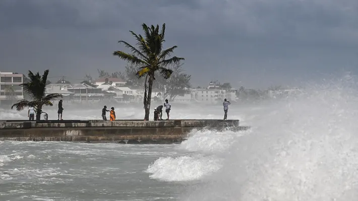
Although Erin is forecast to remain well offshore, its massive footprint is already generating towering waves and dangerous rip currents that stretch hundreds of miles. The National Weather Service (NWS) warned beachgoers from the Carolinas to New Jersey to avoid swimming, even under sunny skies.
“Even though Erin is expected to remain far offshore, the threat to life from rip currents and high surf along our beaches is very real,” the NWS office in Morehead City, North Carolina, said in a beach hazards statement.
So far this year, 44 people in the U.S. have died from rip currents and other surf hazards, making them deadlier than lightning, tornadoes, or hurricanes combined.
Outer Bands Lash Puerto Rico, Bahamas, and Turks and Caicos
Erin’s outer rain bands swept across Puerto Rico, triggering flash flooding, landslides, and leaving 100,000 people without power, Gov. Jennifer González-Colón reported Sunday. Up to 2 more inches of rain are forecast for the island through Monday night under a flood watch.
The Turks and Caicos Islands and southeast Bahamas are under tropical storm warnings, with as much as 6 inches of rain possible by Tuesday. A tropical storm watch is also in effect for the central Bahamas. Officials warn of flash floods and mudslides in vulnerable areas.
Evacuations Ordered in North Carolina
On Sunday, Dare County, North Carolina, declared a state of emergency and issued a mandatory evacuation for Hatteras Island. Officials expect coastal flooding and ocean overwash to make portions of N.C. Highway 12 is impassable for several days beginning Tuesday.
“This is not the week to swim in the ocean,” Dare County Emergency Management cautioned. “The risk from surf and flooding will be life-threatening.”
Bermuda Braces for Impact
Forecasters warn Bermuda could see very rough seas and tropical-storm-force winds later this week as Erin curves north-northeast between the U.S. East Coast and the island.
Climate and Hurricane Season Outlook
Meteorologists say Erin’s explosive strengthening highlights how warmer seas are fueling more intense storms. While sea surface temperatures aren’t quite as extreme as the record-breaking 2023 and 2024 seasons, they remain well above historical averages.
Erin is the first hurricane of the Atlantic season after four weaker tropical storms. Another tropical wave trailing behind Erin already has a medium chance of development in the coming week.
The peak of hurricane season runs from mid-August to mid-October, and forecasters expect above-average activity this year.