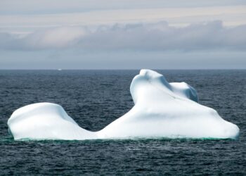


A giant iceberg nearly 30 square miles in area broke away from Greenland’s Petermann Glacier this summer, drifted through a fjord and then slammed into a rocky island without breaking apart.
The unusual journey was documented by satellites, offering scientists a close look at the movement of one of the largest icebergs to calve from Petermann Glacier in more than a decade.
The tabular iceberg measured just over 76 square kilometres, or about 29 square miles, when it separated from the glacier. It was the glacier’s biggest calving event since a roughly 130-square-kilometre iceberg broke away in 2012. NASA said the 2026 event was also the largest calving event by any Arctic glacier since 2020.
How did the giant iceberg break away?
The event was first identified on August 4 by Adam Garbo, a doctoral student in glaciology at the University of Ottawa, using imagery from the European Space Agency’s Sentinel-1 satellites.
Garbo and an international team have been monitoring Petermann Glacier and its floating ice tongue using satellite and other remote-sensing data.
Researchers had been expecting a much larger calving event because several major cracks had developed across the ice tongue. Instead, the glacier fractured along a different crack, producing a smaller iceberg than anticipated.
Two other major rifts remained visible in late August. Scientists estimated they could eventually release ice islands measuring roughly 94 and 84 square kilometres, although the timing of any future break remains uncertain.
The iceberg began moving toward Nares Strait
After separating from Petermann Glacier, the huge slab of ice began drifting down Petermann Fjord toward Nares Strait.
During its first week, it travelled at an average rate of about 3 kilometres per day. Scientists tracked its progress using NASA-USGS Landsat imagery.
The iceberg then reached the mouth of the fjord, where a small rocky outcrop called Joe Island stood directly in its path.
Satellite images captured the encounter on August 23 and August 24 using the Operational Land Imager aboard Landsat 9.
It slammed into Joe Island but did not break apart
Collisions between Petermann icebergs and Joe Island are not unusual, and they can trigger fragmentation.
The 2010 Petermann ice island, for example, was split apart after encountering the island. Petermann’s floating icebergs can also be relatively thin compared with some of the giant bergs produced elsewhere in Greenland and Antarctica.
This time, however, the outcome was different.
The 2026 iceberg pivoted around Joe Island and continued into Nares Strait largely intact. Garbo said researchers were closely watching the encounter and were surprised that the iceberg survived without further fragmentation.
How big was the iceberg?
The iceberg covered slightly more than 76 square kilometres, equivalent to about 29 square miles.
That is roughly the size of St. Thomas in the US Virgin Islands, according to NASA. It was the largest piece to detach from Petermann Glacier since the 2012 event, when an ice island measuring about 130 square kilometres broke away.
Petermann also experienced major calving events in 2008 and 2010. The 2010 event produced an ice island measuring more than 250 square kilometres.
The 2026 iceberg was estimated to have been less than 150 metres, or about 490 feet, thick when it separated from the glacier.
Why is Petermann Glacier important?
Petermann is one of Greenland’s major marine-terminating glaciers. Its floating ice tongue extends into the ocean and helps regulate how ice from the Greenland Ice Sheet moves toward the sea.
Scientists therefore monitor changes in the glacier not simply because large icebergs are spectacular to observe, but because changes to floating ice can provide clues about the longer-term stability and behavior of the glacier.
A single calving event does not automatically mean a glacier is collapsing. Icebergs breaking away are a normal part of the life cycle of marine-terminating glaciers.
What concerns researchers is the broader pattern of ice loss, thinning, retreat and changes in glacier flow over time.
Does the iceberg’s separation directly raise sea levels?
Not in the same way as melting land-based ice.
The chunk that broke away was already floating as part of Petermann’s ice tongue. When floating ice melts, it does not produce the same direct sea-level contribution as ice that was previously sitting on land and then enters the ocean.
However, scientists still watch such events carefully because the loss of floating ice can affect the mechanics of the glacier behind it.
Petermann’s floating tongue provides some resistance to ice flowing from the Greenland Ice Sheet toward the ocean. Changes in its geometry and stability could therefore influence the glacier system beyond the immediate iceberg itself.
Where is the iceberg headed now?
After surviving its encounter with Joe Island, the iceberg continued southwest through Nares Strait.
Researchers expect wind, currents, tides and melting to gradually weaken it. It is likely to fragment over time, although large ice islands can travel considerable distances before breaking apart or becoming grounded.
For vessels and infrastructure operating in the region, that movement can create a hazard. As the iceberg melts, it will also release freshwater into the surrounding ocean.
Why satellite images matter
The episode is another example of how satellites are transforming glacier research.
Sentinel-1 radar imagery helped researchers identify the moment the iceberg separated from Petermann Glacier, while Landsat imagery subsequently tracked its journey toward Nares Strait and its encounter with Joe Island.
Because Greenland’s glaciers are remote and difficult to access, these observations allow scientists to follow changes across vast areas without needing people on the ice.
In this case, satellites captured more than a dramatic collision. They recorded a moving piece of Greenland’s ice sheet system as it broke free, navigated a narrow passage and survived an encounter that has shattered other icebergs in the past.