
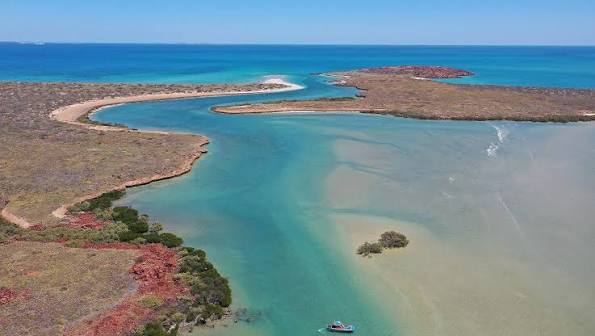
Scientists have mapped a vast ancient landscape hidden beneath the waters of Australia’s Great Barrier Reef, revealing evidence of rivers, lakes, estuaries and beaches that existed before rising seas submerged the region.
The discovery provides a rare glimpse into what the southern Great Barrier Reef region may have looked like thousands of years ago, when sea levels were much lower and Australia’s First Nations peoples were already living on the continent.
Researchers mapped the submerged terrain during a 24-day expedition along the Queensland coast aboard the CSIRO research vessel Investigator. Darumbal Traditional Owners of Sea Country and Woppaburra people were involved in designing the voyage, with researchers combining modern marine science with Indigenous knowledge to reconstruct the landscape’s history.
What was discovered beneath the Great Barrier Reef?
Scientists identified an extensive ancient landscape beneath the seabed and waters of the Great Barrier Reef region.
The mapped features include:
- Rivers
- Lakes
- Estuaries
- Beaches
- Coastal plains
These features reveal that the area now covered by the ocean was once dry land.
The landscape existed during a period when global sea levels were dramatically lower than they are today.
Researchers are now working to understand how that environment changed as sea levels rose and eventually covered the landscape.
How old is the submerged landscape?
The researchers say the landscape was part of the environment occupied by Australia’s First Nations peoples during the period when sea levels were around 80 meters below today’s levels.
The expedition team points to evidence that First Nations people arrived in Australia more than 65,000 years ago.
At that time, the region around what is now the Great Barrier Reef would have looked very different.
Instead of being largely underwater, it would have included a broad coastal plain extending outward from the present shoreline.
Helen Bostock, chief scientist for the voyage, said the landscape was bordered by extensive forests that stretched inland.
Why was sea level so much lower?
The landscape existed during the last Ice Age, when enormous amounts of Earth’s water were locked up in glaciers and ice sheets.
With less water in the oceans, global sea levels fell dramatically.
As the planet warmed and ice sheets melted, sea levels rose.
Over thousands of years, areas that had once been coastal plains, river systems and wetlands were gradually inundated.
The landscape beneath the Great Barrier Reef is therefore a physical record of that transformation.
How did scientists map the landscape?
The researchers used advanced sonar technology aboard the Investigator to map the seafloor.
Sonar allows scientists to build detailed images of underwater terrain by sending sound waves toward the seabed and measuring their return.
That makes it possible to identify geological features that cannot be seen from the ocean surface.
In this case, the mapping revealed the outlines of former rivers, lakes, estuaries and beaches.
The result is effectively a geological map of a landscape that disappeared beneath rising seas.
Why is the discovery important for archaeology?
The submerged landscape may help researchers understand where people could have lived thousands of years ago.
When sea levels were lower, the area would have provided access to freshwater, vegetation and coastal resources.
Rivers and estuaries could have supported human communities, while beaches and wetlands may have provided additional food resources.
However, the mapping itself does not prove that a particular ancient community lived at every location identified by the researchers.
The archaeological evidence will have to establish where people actually lived and how they used the landscape.
How could Indigenous knowledge help?
The expedition involved Darumbal Traditional Owners of Sea Country and Woppaburra people.
This collaboration is important because Indigenous communities maintain cultural knowledge connected to the region and its history.
Researchers are combining that knowledge with sonar maps and geological evidence to reconstruct the submerged environment.
The goal is not simply to produce a physical map.
It is to build a more complete understanding of how people interacted with the landscape before it disappeared beneath the sea.
What are sediment cores?
Scientists collected more than 20 sediment cores during the expedition.
A sediment core is essentially a vertical sample taken from the seabed.
Each layer can preserve clues about what happened in the environment at different points in time.
Researchers can analyze the material for fossils, biological remains, minerals and other evidence.
That can help reconstruct:
- Ancient vegetation
- Climate conditions
- Sea-level changes
- Animal life
- Environmental transitions
The sediment therefore acts like a natural historical record.
Why are fossils important?
Fossils preserved in marine sediments can provide clues about the environment that existed before the area was submerged.
Plant remains could reveal what vegetation once grew there.
Animal fossils could indicate which species occupied the landscape.
Microscopic organisms can also provide information about ancient water temperatures, salinity and environmental conditions.
By combining those clues with the sonar map, scientists can potentially reconstruct a much more detailed picture of the vanished landscape.
What will researchers study next?
The expedition is only the beginning of the investigation.
Scientists plan to reconstruct how the region changed over time by studying climate, sea-level rise and vegetation.
They also want to understand how the southern Great Barrier Reef evolved as the landscape transitioned from a terrestrial environment to a marine one.
That could reveal how ecosystems responded to major environmental change.
Could the discovery help scientists understand climate change?
Yes.
Ancient landscapes provide natural records of how coastlines respond to changes in sea level.
Researchers can examine what happened when sea levels rose at the end of the last Ice Age and compare that with modern projections.
That does not provide a perfect model for today’s climate because modern warming is occurring under different circumstances.
But understanding how coastal environments responded to past changes can provide useful information about the processes that shape reefs, coastlines and marine ecosystems.
Could the ancient landscape have looked like today’s Australia?
Probably not.
The region’s climate, vegetation, coastline and wildlife would have been different thousands of years ago.
The Great Barrier Reef as we know it today developed through a long and complex process as sea levels changed and coral ecosystems expanded.
The submerged terrain represents an earlier stage in that history.
Researchers therefore hope to reconstruct not only the shape of the ancient land but also the environmental conditions under which people and wildlife lived.
What happened to the landscape?
The landscape was gradually flooded as sea levels rose.
Former river channels became underwater features.
Coastal plains disappeared beneath the sea.
Estuaries transformed into marine environments.
Beaches and shorelines moved inland as the ocean advanced.
Over thousands of years, the landscape that had once supported terrestrial ecosystems became part of the modern Great Barrier Reef environment.
Its physical features, however, remain preserved beneath the water.
Why is the Great Barrier Reef region especially valuable for this research?
The Great Barrier Reef is one of the world’s largest and most complex marine ecosystems.
Its geological history is closely connected with fluctuations in sea level.
That makes the area particularly valuable for studying how landscapes and ecosystems respond to major environmental changes.
The newly mapped features provide researchers with an opportunity to examine that history in exceptional detail.
Does the discovery prove humans lived on the submerged land?
Not by itself.
The evidence demonstrates that a substantial terrestrial landscape existed there.
The researchers say First Nations people were present in Australia more than 65,000 years ago, when sea levels were much lower.
That makes human use of such landscapes plausible and scientifically important to investigate.
But specific evidence of human occupation — such as tools, hearths, food remains or other archaeological material — would be needed to establish exactly where people lived and how they used the submerged terrain.
Why does this matter to First Nations history?
The discovery expands the geographic context in which Australia’s ancient human history can be understood.
Modern coastlines do not necessarily reflect the environments in which the continent’s earliest inhabitants lived.
When sea levels were lower, Australia’s coastline extended much farther than it does today.
Some areas that are now underwater could once have been places where people traveled, hunted, gathered food or established temporary settlements.
Reconstructing those landscapes can therefore help researchers better understand the changing homeland of Australia’s First Nations peoples.
What makes the Investigator expedition significant?
The 24-day voyage brought together multiple types of expertise.
Marine scientists used sonar and sediment sampling to examine the physical environment.
Traditional Owners contributed cultural knowledge about the region.
Together, those approaches provide a broader perspective than either scientific mapping or historical knowledge alone.
The researchers hope that combining these sources will produce a richer reconstruction of how the southern Great Barrier Reef changed over thousands of years.
The bigger picture
Beneath Australia’s Great Barrier Reef lies a record of a world that no longer exists above the waves.
Rivers, lakes, estuaries, beaches and coastal plains once occupied areas that are now underwater.
Researchers have now mapped these features in unprecedented detail and are beginning the process of reconstructing their history.
The timing is particularly significant because First Nations people were already living in Australia more than 65,000 years ago, when sea levels were dramatically lower.
The discovery does not by itself prove that people lived at every location beneath the modern reef.
But it provides a new map of the landscape that Australia’s early inhabitants would have encountered.
More than 20 sediment cores could now help researchers determine what the climate, vegetation and ecosystems looked like and how quickly the region changed as sea levels rose.
By combining that evidence with the knowledge of Darumbal Traditional Owners and the Woppaburra people, scientists hope to reconstruct a lost chapter of Australia’s environmental and human history.
The landscape may have disappeared beneath the ocean thousands of years ago.
Its story, however, is only now being brought back to the surface.